David Rumsey
ArcGIS, QGIS or web apps can simply use this map with web map services. WMTS, TileJSON or XYZ tiles are provided for quick access to processed maps.
Sign in to get links.
Sign in to download GeoTIFF.
Overlay & compare
iiif viewer, iiif info json
Website
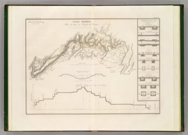
Canal Morris.
2329.004
pilot3
Canal Morris. Plan du trace et profiles du canal. Etat du New-Jersey. Dessine par le Major Poussin. Grave par (V.?) Adam. (1834)
1834
Poussin, Guillaume Tell, 1794-1876
Libraire Carilian-Goeury
54 × 39 cm
1 : 250000