David Rumsey
ArcGIS, QGIS or web apps can simply use this map with web map services. WMTS, TileJSON or XYZ tiles are provided for quick access to processed maps.
Sign in to get links.
Sign in to download GeoTIFF.
Overlay & compare
iiif viewer, iiif info json
Website
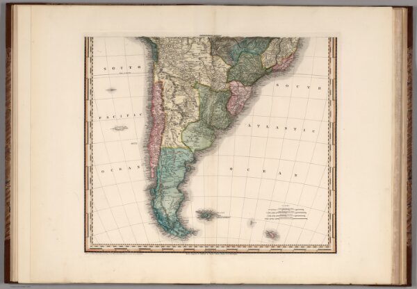
South America and West Indies. 1818
2593.021
pilot4
South America and West Indies. 1818. (southern section) Drawn, Engraved & Published by Tanner, Vallance, Kearney & Co. Philadelphia. Entered ... 8th day of June, 1818, by Tanner, Vallance, Kearney & Co. ... Pennsylvania. American Atlas.
1818
1833
Tanner, Henry S.
Henry Tanner
54 × 47 cm
1 : 10500000