David Rumsey
ArcGIS, QGIS or web apps can simply use this map with web map services. WMTS, TileJSON or XYZ tiles are provided for quick access to processed maps.
Sign in to get links.
Sign in to download GeoTIFF.
Overlay & compare
iiif viewer, iiif info json
Website
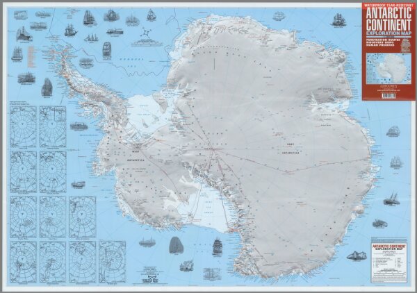
Antarctic Continent: Exploration Map
11728.000
missinglocation
Antarctic Continent: Exploration Map : Penetration Routes, Discovery Ships, Human Presence. Antarctic Continent: Exploration Map. Zagier & Urruty Publications, Argentina. Direction & design Sergio Zagier. Drawing: Andrea Munita & Andrea Daffunchio. 2005, 2015 Zagier & Urruty.
2015
Zagier, Sergio.
Zagier & Urruty Publications
98 × 68 cm
1 : 6800000