David Rumsey
ArcGIS, QGIS or web apps can simply use this map with web map services. WMTS, TileJSON or XYZ tiles are provided for quick access to processed maps.
Sign in to get links.
Sign in to download GeoTIFF.
Overlay & compare
iiif viewer, iiif info json
Website
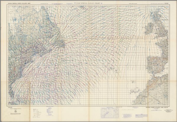
Central North Atlantic area Loran chart (LS-103)
11626.000
missinglocation
USAF special Loran chart. (LS-103) Central, North Atlantic area. 3rd. edition 1954. Published by the USAF Aeronautical Chart and Information Center, St. Louis.
1954
United States. Aeronautical Chart Service
USAF Aeronautical Chart and Information Center
136 × 86 cm
1 : 5000000