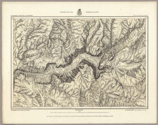
Topographical Map Of The Yosemite Valley And Vicinity. Preliminary Edition.
Identifier
2738.110
Collection
pilot3
Description
Topographical Map Of The Yosemite Valley And Vicinity. Preliminary Edition. Part Of East Central California. Mountain Drawing by J.E. Weyss; Lettering by J. Franke. From Topographical Plat by Lt. Macomb, Nov. 30, 1883. Julius Bien & Co. Photo. lith. Expeditions Of 1878-79, Under the Command of Capt. Geo. M. Wheeler, Corps of Engineers, U.S. Army. U.S. Geographical Surveys West Of The 100th Meridian.