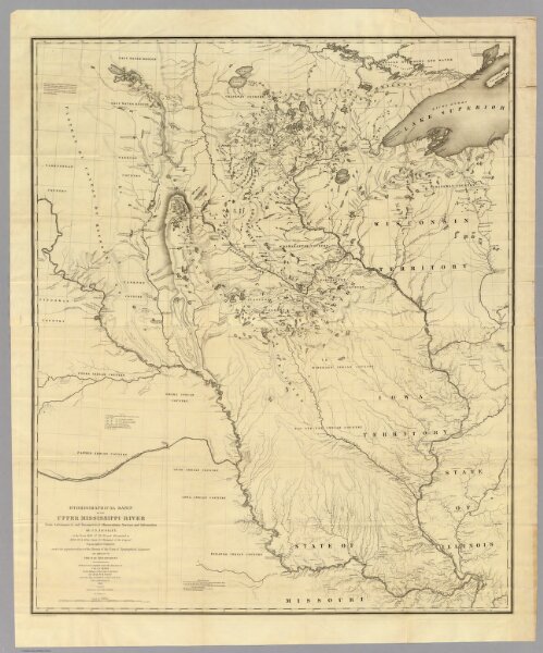
Hydrographical Basin of the Upper Mississippi River.
Identifier
2488.001
Collection
pilot4
Description
Hydrographical Basin of the Upper Mississippi River From Astronomical and Barometrical Observations Surveys and Information by J.N. Nicollet ... assisted ... by Lieut. J.C. Fremont ... Reduced and compiled under the direction of Col. J.J. Abert in the Bureau of the Corps of Topl. Engrs. by Lieut. W.H. Emory ... 1843 ... W.J. Stone Sc.