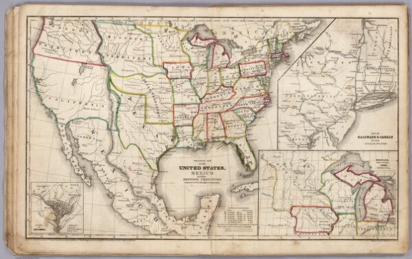
Political Map Of The United States, Mexico and British provinces
Identifier
1231.012
Collection
missinglocation
Description
Political Map Of The United States, Mexico And The British Provinces. Adapted To Woodbridge's Geography. Engraved by J. M. Atwood. N. York. Entered .. . 1845, by W.C. Woodbridge ... Massachusetts. Hartford. Published By Wm. Jas. Hamersley. (inset) Map of Railways & Canals In the Middle States. (inset map) Michigan, Wisconsin, Iowa, Minesota. (Inset map) District Of Columbia.