David Rumsey
ArcGIS, QGIS or web apps can simply use this map with web map services. WMTS, TileJSON or XYZ tiles are provided for quick access to processed maps.
Sign in to get links.
Sign in to download GeoTIFF.
Overlay & compare
iiif viewer, iiif info json
Website
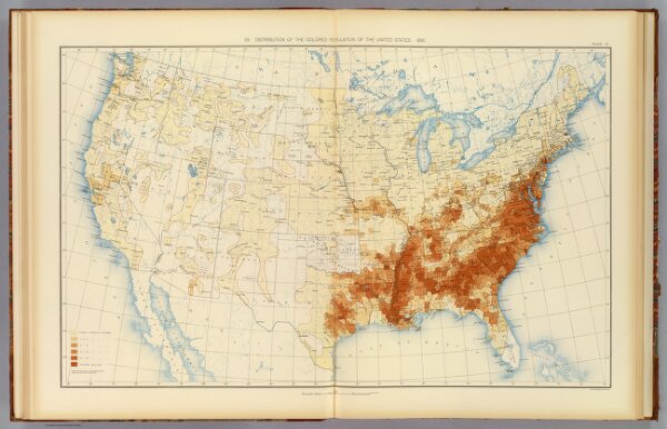
10. Colored population 1890.
1873.010
pilot4
29. Distribution of the colored population of the United States: 1890. Julius Bien & Co. Lith., N.Y. (1898)
1898
Gannett, Henry, 1846-1914; United States. Census Office
U.S. Census Office
72 × 46 cm
1 : 7000000