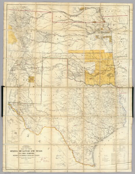
Map Of The States Of Kansas And Texas And Indian Territory.
Identifier
2320.001
Collection
pilot4
Description
Engineer Bureau, War Department. Map Of The States Of Kansas And Texas And Indian Territory, With Parts Of The Territories Of Colorado And New Mexico. From the most recent official surveys and explorations and other authentic information. 1867. J. Bien, Lith. 24 Vesey St. N.Y.