David Rumsey
ArcGIS, QGIS or web apps can simply use this map with web map services. WMTS, TileJSON or XYZ tiles are provided for quick access to processed maps.
Sign in to get links.
Sign in to download GeoTIFF.
Overlay & compare
iiif viewer, iiif info json
Website
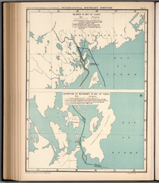
Plate 92. International Boundary Disputes. Bay of Fundy.
0702.095
pilot
Plate 92. International Boundary Disputes. Islands in the Bay of Fundy. Definition of Boundary in Bay of Fundy.
1932
Wright, John K.
American Geographical Society of New York
25 × 34 cm