David Rumsey
ArcGIS, QGIS or web apps can simply use this map with web map services. WMTS, TileJSON or XYZ tiles are provided for quick access to processed maps.
Sign in to get links.
Sign in to download GeoTIFF.
Overlay & compare
iiif viewer, iiif info json
Website
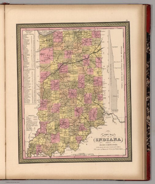
New Map of Indiana with its Roads & Distances
0545.034
pilot
A New Map of Indiana with its Roads & Distances. Published By S. Augustus Mitchell. N.E. corner of Market & 7th. Streets. Philadelphia. (inset) Profile of the Wabash and Erie Canal.
1849
Mitchell, Samuel Augustus
S.A. Mitchell
29 × 35 cm
1 : 1400000