David Rumsey
ArcGIS, QGIS or web apps can simply use this map with web map services. WMTS, TileJSON or XYZ tiles are provided for quick access to processed maps.
Sign in to get links.
Sign in to download GeoTIFF.
Overlay & compare
iiif viewer, iiif info json
Website
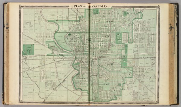
Plan of Indianapolis.
0019.100
missinglocation
Plan of Indianapolis by S.W. Durant, civil engineer, St. Charles, Ills. (Published by Baskin, Forster & Co. Lakeside Building Chicago, 1876. Engraved & Printed by Chas. Shober & Co. Props. of Chicago Lithographing Co.)
1876
Durant, Samuel W.
Baskin, Forster & Co.
63 × 44 cm
1 : 18000