David Rumsey
ArcGIS, QGIS or web apps can simply use this map with web map services. WMTS, TileJSON or XYZ tiles are provided for quick access to processed maps.
Sign in to get links.
Sign in to download GeoTIFF.
Overlay & compare
iiif viewer, iiif info json
Website
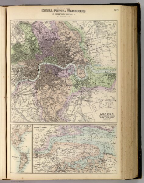
England and Wales, Cities, Ports & Harbours.
3007.027
pilot3
England and Wales, Cities, Ports & Harbours. 1st Metropolitan District &c. By J. Bartholomew, F.R.G.S. XXVI. Drawn & Engraved by J. Bartholomew, F.R.G.S. A. Fullarton & Co. London and Edinburgh.
1872
Fullarton, A. & Co.
A. Fullarton & Co.
29 × 45 cm
1 : 63360