David Rumsey
ArcGIS, QGIS or web apps can simply use this map with web map services. WMTS, TileJSON or XYZ tiles are provided for quick access to processed maps.
Sign in to get links.
Sign in to download GeoTIFF.
Overlay & compare
iiif viewer, iiif info json
Website
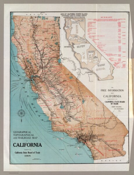
Map of California.
5644.001
pilot4
Geographical, topographical and railroad map of California. Published by the California State Board of Trade, 1908. Copyrighted 1907.
1908
California State Board of Trade
51 × 65 cm
1 : 1770000