David Rumsey
ArcGIS, QGIS or web apps can simply use this map with web map services. WMTS, TileJSON or XYZ tiles are provided for quick access to processed maps.
Sign in to get links.
Sign in to download GeoTIFF.
Overlay & compare
iiif viewer, iiif info json
Website
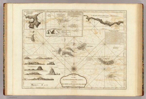
Chart of the Acores (Hawks) Islands.
4723.003
pilot4
Chart of the Acores (Hawks) Islands, called also Flemish and Western Islands. London, Printed for Robert Sayer, as the Act directs May 1st, 1787.
1787
1788
Jefferys, Thomas
Sayer and Bennett
62 × 47 cm
1 : 1550000