David Rumsey
ArcGIS, QGIS or web apps can simply use this map with web map services. WMTS, TileJSON or XYZ tiles are provided for quick access to processed maps.
Sign in to get links.
Sign in to download GeoTIFF.
Overlay & compare
iiif viewer, iiif info json
Website
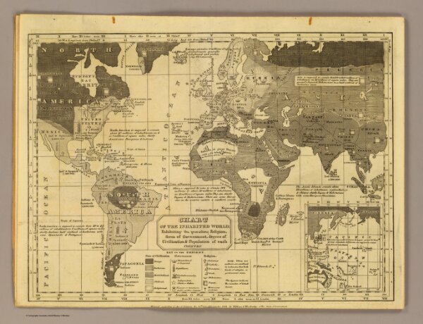
Inhabited World.
5031.002
pilot4
Chart of the inhabited World; exhibiting the prevailing religion, form of government, degree of civilization & population of each country. Entered ... 1821 by William C. Woodbridge of the state of Connecticut. (1824?)
1824
Woodbridge, William C.
Oliver D. Cook & Sons
29 × 23 cm
1 : 93000000