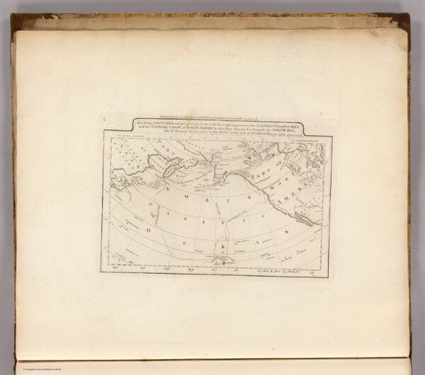
Map of the Discoveries made by Capts. Cook & Clarke in the Years 1778 & 1779.
Identifier
4863.045
Collection
pilot4
Description
A Map of the Discoveries made by Capts. Cook & Clarke in the Years 1778 & 1779 between the Eastern Coast of Asia and the Western Coast of North America, when they attempted to Navigate the North Sea. Also Mr Hearn's discoveries to the North westward of Hudson's Bay, in 1772. J.T. Scott Sculp. Engraved for Carey's Edition of Guthrie's Geography improved.