David Rumsey
ArcGIS, QGIS or web apps can simply use this map with web map services. WMTS, TileJSON or XYZ tiles are provided for quick access to processed maps.
Sign in to get links.
Sign in to download GeoTIFF.
Overlay & compare
iiif viewer, iiif info json
Website
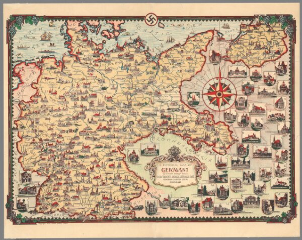
A pictorial map of Germany
10731.000
pilot5
A pictorial map of Germany by Ernest Dudly Chase. Colortext publications Inc. Chicago, Illinois. USA. Copyright 1935, Ernest Dudly Chase.
1935
Colortext Publications Inc.
41 × 30 cm