David Rumsey
ArcGIS, QGIS or web apps can simply use this map with web map services. WMTS, TileJSON or XYZ tiles are provided for quick access to processed maps.
Sign in to get links.
Sign in to download GeoTIFF.
Overlay & compare
iiif viewer, iiif info json
Website
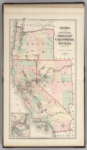
Railroad map of Oregon, California, and Nevada.
4740.060
pilot4
Gray's Atlas New Railroad and County Map of the States of Oregon, California, and Nevada Compiled and Drawn by Frank A. Gray. Published by O.W. Gray, Philadelphia. (inset) Enlarged Plan of the Vicinity of San Francisco and Sacramento.
1874
Gray, Ormando Willis
Stedman, Brown & Lyon
37 × 66 cm
1 : 2508000