David Rumsey
ArcGIS, QGIS or web apps can simply use this map with web map services. WMTS, TileJSON or XYZ tiles are provided for quick access to processed maps.
Sign in to get links.
Sign in to download GeoTIFF.
Overlay & compare
iiif viewer, iiif info json
Website
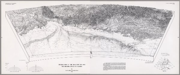
Oblique Map of the Beaufort Sea and the Brooks Range of Alaska.
6353.017
pilot2
1980
1988
Gerin, Marybeth
U.S. Geological Survey
104 × 41 cm