David Rumsey
ArcGIS, QGIS or web apps can simply use this map with web map services. WMTS, TileJSON or XYZ tiles are provided for quick access to processed maps.
Sign in to get links.
Sign in to download GeoTIFF.
Overlay & compare
iiif viewer, iiif info json
Website
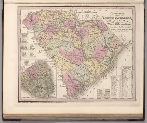
South Carolina.
0976.021
pilot
A New Map of South Carolina with Its Canals, Roads & Distances from place to place along Stage & Steam Boat Routes by H.S. Tanner. (inset) Charleston.
1836
1837
Tanner, Henry S.
H.S. Tanner
34 × 29 cm
1 : 1410000