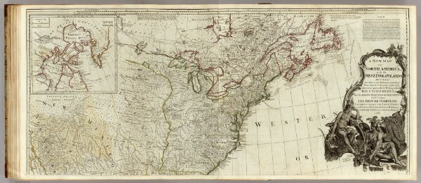
A new map of North America, with the West India Islands (northern section).
Identifier
0411.040
Collection
pilot2
Description
A new map of North America, with the West India Islands. (Northern section). Divided according to the Preliminary Articles of Peace, signed at Versailles, 20. Jan. 1783, wherein are particularly distinguished the United States, and the several provices, governments &ca. which compose the British Dominions; laid down according to the latest surveys, and corrected from the original materials, of Goverr. Pownall, Membr. of Parliamt., 1783. (London, printed for Robt. Sayer, Map, Chart & Printseller, no. 53, Fleet Street, as the Act directs August 15th 1786)