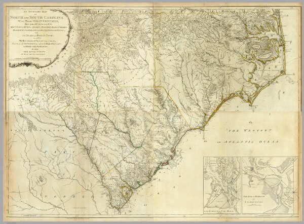
(Composite of) An Accurate Map Of North And South Carolina With Their Indian Frontiers, Shewing in a distinct manner all the Mountains, Rivers, Swamps, Marshes, Bays, Creeks, Harbours, Sandbanks and Soundings on the Coasts; with The Roads and Indian Paths; as well as The Boundary or Provincial Lines, The Several Townships and other divisions of the Land In Both The Provinces; the whole From Actual Surveys By Henry Mouzon And Others. London. Printed for Robt. Sayer and J. Bennett ... May 30th 1775.