David Rumsey
ArcGIS, QGIS or web apps can simply use this map with web map services. WMTS, TileJSON or XYZ tiles are provided for quick access to processed maps.
Sign in to get links.
Sign in to download GeoTIFF.
Overlay & compare
iiif viewer, iiif info json
Website
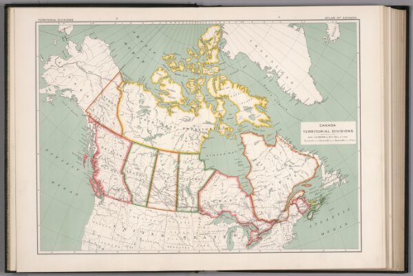
Canada territorial divisions
1646.011
pilot2
Canada territorial divisions. (on upper right margin) Atlas of Canada. (to accompany) Department of the Interior Canada. Atlas Of Canada, 1915.
1915
Chalifour, J.E.
Department of Interior
55 × 39 cm
1 : 12500000