David Rumsey
ArcGIS, QGIS or web apps can simply use this map with web map services. WMTS, TileJSON or XYZ tiles are provided for quick access to processed maps.
Sign in to get links.
Sign in to download GeoTIFF.
Overlay & compare
iiif viewer, iiif info json
Website
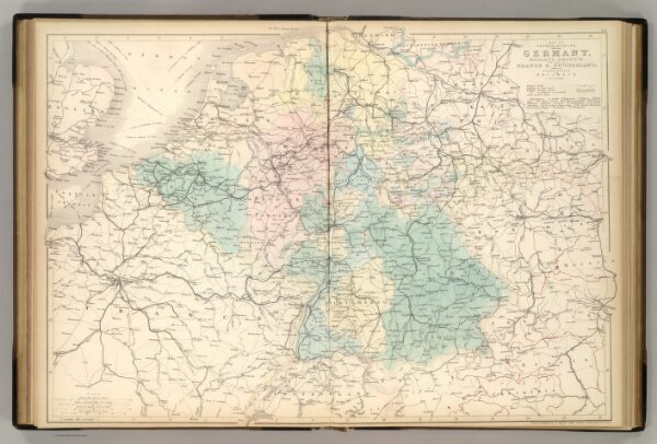
Central Europe.
2305.027
pilot4
Map of Central Europe embracing Germany, Holland, Belgium, France, Switzerland; showing the Roads, Canals, and Railways. By W. Hughes. Drawn & Engraved by W. Hughes; Aldine Chambers, Paternoster Row, London.
1854
Hughes, William
Adam & Charles Black
62 × 43 cm
1 : 2000000