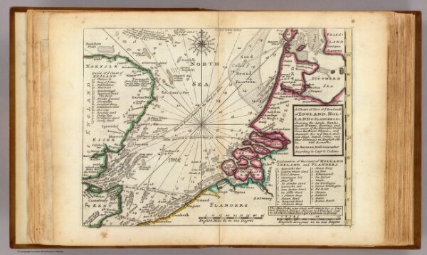
Chart of part of coast of England, Holland & Flanders &c.
Identifier
5580.010
Collection
pilot4
Description
A chart of part of ye sea coast of England, Holland & Flanders &c. Shewing the sands, banks, depth of water, bearing, and the course of the principal tracts from the River Thames, and Harwich, &c. to ye Texel, Helevoet Sluys, Ostend, Calais, and their distances in English miles, with remarks. By Herman Moll Geographer, according to Capt. G. Collins. (Printed and sold by T. Bowles next ye Chapter House in St. Pauls Churchyard, & I. Bowles at ye Black Horse in Cornhill. 1736?)