David Rumsey
ArcGIS, QGIS or web apps can simply use this map with web map services. WMTS, TileJSON or XYZ tiles are provided for quick access to processed maps.
Sign in to get links.
Sign in to download GeoTIFF.
Overlay & compare
iiif viewer, iiif info json
Website
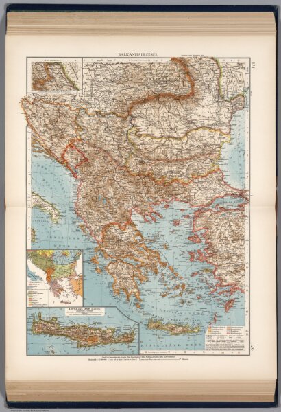
Balkanhalbinsel
1463.068
pilot2
Balkanhalbinsel. Sept. 1905. (insets: nebenkarten) Volkerkarte ; Kreta Oder Kriti (Kandia) ; (continuation of map).
1905
1906
Scobel, Albert
Velhagen & Klasing
41 × 51 cm
1 : 3000000