David Rumsey
ArcGIS, QGIS or web apps can simply use this map with web map services. WMTS, TileJSON or XYZ tiles are provided for quick access to processed maps.
Sign in to get links.
Sign in to download GeoTIFF.
Overlay & compare
iiif viewer, iiif info json
Website
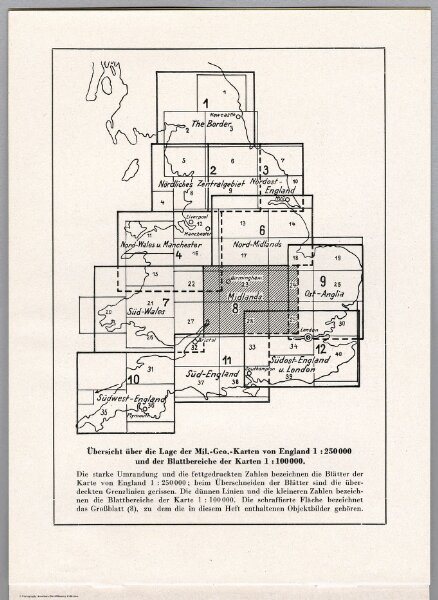
Index Map: Ubersicht uber die Lage der Mil.-Geo.-Karten von England 1:250,000.
7807.472
missinglocation
(Index Map) Ubersicht uber die Lage der Mil.-Geo.-Karten von England 1:250,000 und der Blattbereiche der Karten 1:100,000.
1941
1940
Oberkommando der Wehrmacht (OKW) (Nazi German Supreme Command of the Armed Forces)
Generalstab des Heeres, (Military High Command).
13 × 17 cm