David Rumsey
ArcGIS, QGIS or web apps can simply use this map with web map services. WMTS, TileJSON or XYZ tiles are provided for quick access to processed maps.
Sign in to get links.
Sign in to download GeoTIFF.
Overlay & compare
iiif viewer, iiif info json
Website
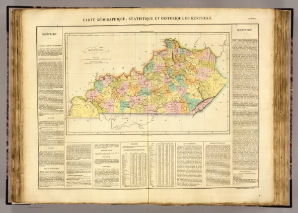
Kentucky.
0102.027
pilot4
Carte geographique, statistique et historique du Kentucky. Kentucky. Fonderie et Imprimerie de J. Carez. (1825)
1825
Buchon, J. A. C.; Carey, H. C.; Lea, I.
J. Carez
62 × 48 cm
1 : 13800000