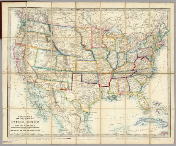
Stanford's New Large-Print Map Of The United States Of North America. Distinguishing The Cities & Towns According To Population &c. And Shewing The Boundary Of The Seceded States. London: Edward Stanford, 6, Charing Cross, May 13th 1861. Constructed & Engrd. at Stanford's Geographical Establishmt. London.