David Rumsey
ArcGIS, QGIS or web apps can simply use this map with web map services. WMTS, TileJSON or XYZ tiles are provided for quick access to processed maps.
Sign in to get links.
Sign in to download GeoTIFF.
Overlay & compare
iiif viewer, iiif info json
Website
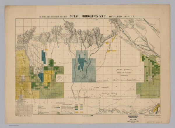
Ontario. Detail Irrigation Map.
5830.006
pilot
California State Engineering Department. Detail Irrigation Map. Ontario Sheet. Wm. Ham. Hall, State Engineer. Irrigation Data 1888. Scale 1 1/2 Inches to One Mile. George Sandow, Draughtsman.
1888
California Department of Engineering
70 × 53 cm
1 : 42240