David Rumsey
ArcGIS, QGIS or web apps can simply use this map with web map services. WMTS, TileJSON or XYZ tiles are provided for quick access to processed maps.
Sign in to get links.
Sign in to download GeoTIFF.
Overlay & compare
iiif viewer, iiif info json
Website
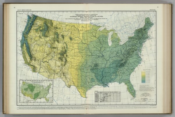
Spring Precipitation. Atlas of American Agriculture.
5797.045
pilot4
Average Spring Precipitation in Inches. (inset) Percent of Precipitation Occurring during the Spring ... Atlas of American Agriculture.
1916
1936
Marschner, Francis, J.
U.S. Department of Agriculture
62 × 48 cm
1 : 8000000