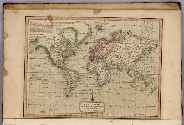
The World. On Mercator's Projection; With All The Latest Discoveries. (engraved by) H.S. Tanner. Sc. Published ... 1814 by J. Melish. J. Vallance & H.S. Tanner. Philadelphia. Map showing: "To find the Distance Of One Place From another." (to accompany) A New Juvenile Atlas, And Familiar Introduction To The Use Of Maps: With A Comprehensive View Of The Present State Of The Earth ... First American From The Latest London Edition, Corrected And Improved, By John Melish. Philadelphia, Printed For John Melish, John Vallance, And H.S. Tanner, No. 209, Chestnut-Street, By G. Palmer. 1814.