David Rumsey
ArcGIS, QGIS or web apps can simply use this map with web map services. WMTS, TileJSON or XYZ tiles are provided for quick access to processed maps.
Sign in to get links.
Sign in to download GeoTIFF.
Overlay & compare
iiif viewer, iiif info json
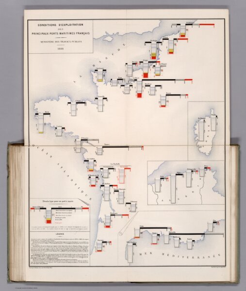
Conditions D'Exploitation des Principaux Ports Maritimes Francais. 1888.
12519.026
missinglocation
Conditions D'Exploitation des Principaux Ports Maritimes Francais. 1888. (Operating conditions of the principal French seaports.)
1888
Cheysson, Émile
Imprimie Nationale
49 × 63 cm