David Rumsey
ArcGIS, QGIS or web apps can simply use this map with web map services. WMTS, TileJSON or XYZ tiles are provided for quick access to processed maps.
Sign in to get links.
Sign in to download GeoTIFF.
Overlay & compare
iiif viewer, iiif info json
Website
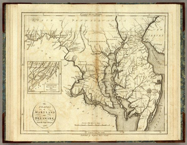
States of Maryland and Delaware.
0845.013
pilot4
The States of Maryland and Delaware, from the latest Surveys. 1795. D. Martin scupt. Published by Wayland, Reid & Smith. (with inset) Continuation of the Potowmac River from Fort Cumberland.
1796
Winterbotham, W.
John Reid
44 × 37 cm
1 : 800000