David Rumsey
ArcGIS, QGIS or web apps can simply use this map with web map services. WMTS, TileJSON or XYZ tiles are provided for quick access to processed maps.
Sign in to get links.
Sign in to download GeoTIFF.
Overlay & compare
iiif viewer, iiif info json
Website
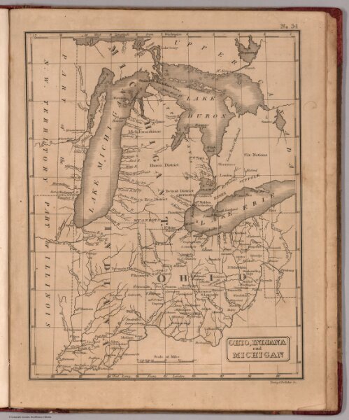
Ohio, Indiana and Michigan
4884.034
pilot2
Ohio, Indiana and Michigan.Young & Delleker, Sc. (to accompany) The Juvenile Atlas or a Series Of Maps, To Illustrate the Old and New Worlds ...1822.
1822
Lea, Isaac
H.C. Carey & I. Lea
19 × 25 cm
1 : 4100000