David Rumsey
ArcGIS, QGIS or web apps can simply use this map with web map services. WMTS, TileJSON or XYZ tiles are provided for quick access to processed maps.
Sign in to get links.
Sign in to download GeoTIFF.
Overlay & compare
iiif viewer, iiif info json
Website
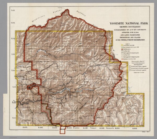
Yosemite National Park
5871.000
pilot
Yosemite National Park, showing boundaries established by act of Congress : approved June 11, 1906, and lands eliminated therefrom and placed in the Sierra Forest Reservation. The Norris Peters Co., Washington D.C.
1906
The Norris Peters Co.
69 × 63 cm
1 : 126720