David Rumsey
ArcGIS, QGIS or web apps can simply use this map with web map services. WMTS, TileJSON or XYZ tiles are provided for quick access to processed maps.
Sign in to get links.
Sign in to download GeoTIFF.
Overlay & compare
iiif viewer, iiif info json
Website
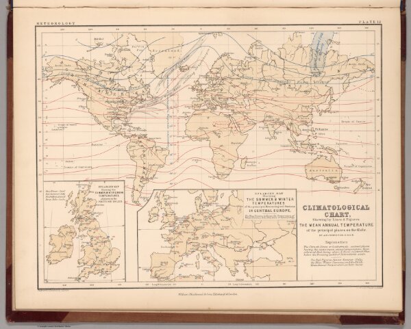
Climatological Chart, Showing by Lines & Figures the Mean Annual Temperature
0370.020
pilot
Climatological Chart, Showing by Lines & Figures the Mean Annual Temperature of the principal places on the Globe.
1852
Johnston, A. Keith
William Blackwood & Sons
32 × 25 cm
1 : 130000000