David Rumsey
ArcGIS, QGIS or web apps can simply use this map with web map services. WMTS, TileJSON or XYZ tiles are provided for quick access to processed maps.
Sign in to get links.
Sign in to download GeoTIFF.
Overlay & compare
iiif viewer, iiif info json
Website
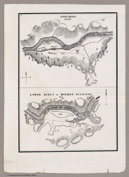
Upper Mines, Lower Mines or Mormon Diggings
3459.002
missinglocation
Upper Mines. Nos. 1&8. Lower Mines or Mormon Diggings. No. 3. (with, on one sheet) Positions of the Upper and Lower Gold Mines on the South Fork of the American River, California. July 20th, 1848.
1848
Mason, Richard B.
U.S.
16 × 23 cm