David Rumsey
ArcGIS, QGIS or web apps can simply use this map with web map services. WMTS, TileJSON or XYZ tiles are provided for quick access to processed maps.
Sign in to get links.
Sign in to download GeoTIFF.
Overlay & compare
iiif viewer, iiif info json
Website
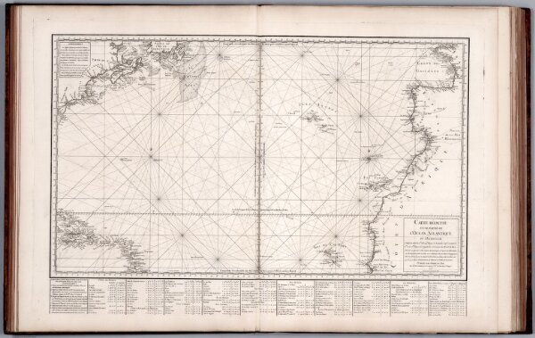
Carte Reduite d'une Partie de l'Ocean Atlantique ou Occidental.
12059.027
missinglocation
1775
1765
Bellin, Jacques Nicolas, 1703-1772
Chez M. Bellin
84 × 56 cm
1 : 158000