David Rumsey
ArcGIS, QGIS or web apps can simply use this map with web map services. WMTS, TileJSON or XYZ tiles are provided for quick access to processed maps.
Sign in to get links.
Sign in to download GeoTIFF.
Overlay & compare
iiif viewer, iiif info json
Website
Mediterranean W.
2104.022
pilot4
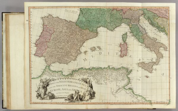
A map of the Mediterranean Sea with the adjacent regions and seas in Europe, Asia and Africa. (West sheet) By William Faden, Geographer to the King. London, printed for Wm. Faden, Charing Cross, March 1st, 1785.
1785
1811
Faden, William, 1750?-1836
William Faden
87 × 61 cm
1 : 2850000