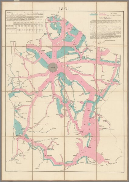
Carte figurative...marchandises...sur les voies d'eau et fer...1861
Identifier
10146.002
Collection
missinglocation
Description
Carte figurative et approximative des tonnages de marchandises qui ont circulé en 1861 sur les voies d'eau et fer de l'Empire français. [Flow of merchandise in France on railways and waterways in the year 1861].