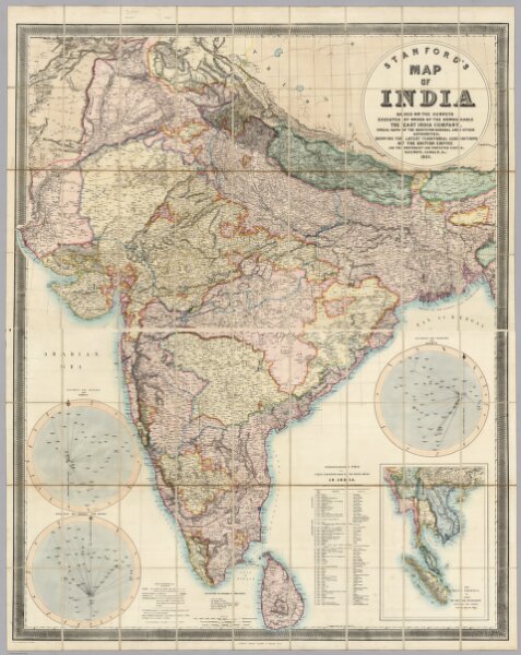
Stanford's Map Of India. Based On The Surveys Executed By Order Of The Honourable The East India Company, Special Maps Of The Surveyor General And Other Authorities; Showing The Latest Territorial Acquisitions And The Independent And Protected States, Railways, Canals, &c. 1859. London: Edward Stanford, 6, Charing Cross. Drawn & Engraved by J. & C. Walker. (inset) The Malay Peninsula &c. Showing The British Possessions Beyond The Ganges. (with 3 additional inset maps).